![]()
Main Menu ·
Search ·
Current Issue · Contact · Archives · Centennial · Letters to the Editor · FAQs
![]()
Main Menu ·
Search ·
Current Issue · Contact · Archives · Centennial · Letters to the Editor · FAQs
|
|
|
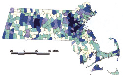
Says John Stilgoe, Orchard professor in the history of landscape development: "I am using the Sanborn maps right now to find out where the industrial waste sites are in America. No one remembers. Many were paved over during the building of the interstate highway system in the 1960s. These maps can serve down through the decades as a visual time tunnel back into another environment."
|
|
|
Main Menu ·
Search · Current Issue · Contact · Archives · Centennial · Letters to the Editor · FAQs
![]()
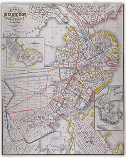 One of Cobb's ambitions is to build on strength and buy every map ever made of New England, in original or facsimile copies, and form within the collection a Center for the History of New England Cartography. This map of Boston, published there in 1857 by George G. Smith, captures the city just before major expansion. The railroad crosses the swampy Back Bay and its layout of streets has been imagined, but building has not yet occurred. The Common is well established, but the Public Garden is just beginning. Early bridges span the Charles into Cambridge and Charlestown. Dorchester and Roxbury have not yet been annexed.
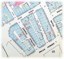 From Daniel Sanborn's Insurance Map of Boston, an atlas published in New York in 1867. These maps were made for the use of fire insurers and were updated about every 10 years. They show each existing building, with details of its construction. High-hazard paint and oil companies are highlighted. The collection includes thousands of such maps of U.S. cities and towns, including complete sets for Boston and Cambridge up to 1992.