
The Boston Planning & Development Agency (BPDA) on April 16 approved a framework plan guiding the buildout of Harvard’s 36-acre Enterprise Research Campus (ERC) in Allston. The plan describes a flexible, decades-long vision for the unbuilt portions of the district, which the University envisions as a gateway to a collaborative community for business, investment capital, research and science development. City of Boston planners anticipate 4 to 6 million square feet of future construction, organized around a flexible land-use model: roughly one-third commercial space, one-third housing, and one-third “flexible uses” such as academic, innovation, or mixed-use space.
First proposed in 2011, the ERC was envisioned as a major technology hub designed to foster collaborations among businesses, investors, researchers, and scientists, similar to Research Triangle Park in North Carolina, situated near three universities. The ERC district lies directly opposite Harvard Business School across Western Avenue, and adjacent to Harvard’s Science and Engineering Complex, completed in 2020.
The framework approved last week updates an earlier 2021 plan, placing a greater emphasis on flexibility. In one of several public meetings focused on the project, BPDA urban planner Matthew Hussman said the change reflects both community feedback and a response to changing market conditions: The ERC will be built over multiple decades, and demand for lab space, offices, or housing may fluctuate significantly during that time. Office space vacancies in Boston currently hover around 20 percent, for instance, while lab space vacancies run closer to 33 percent.
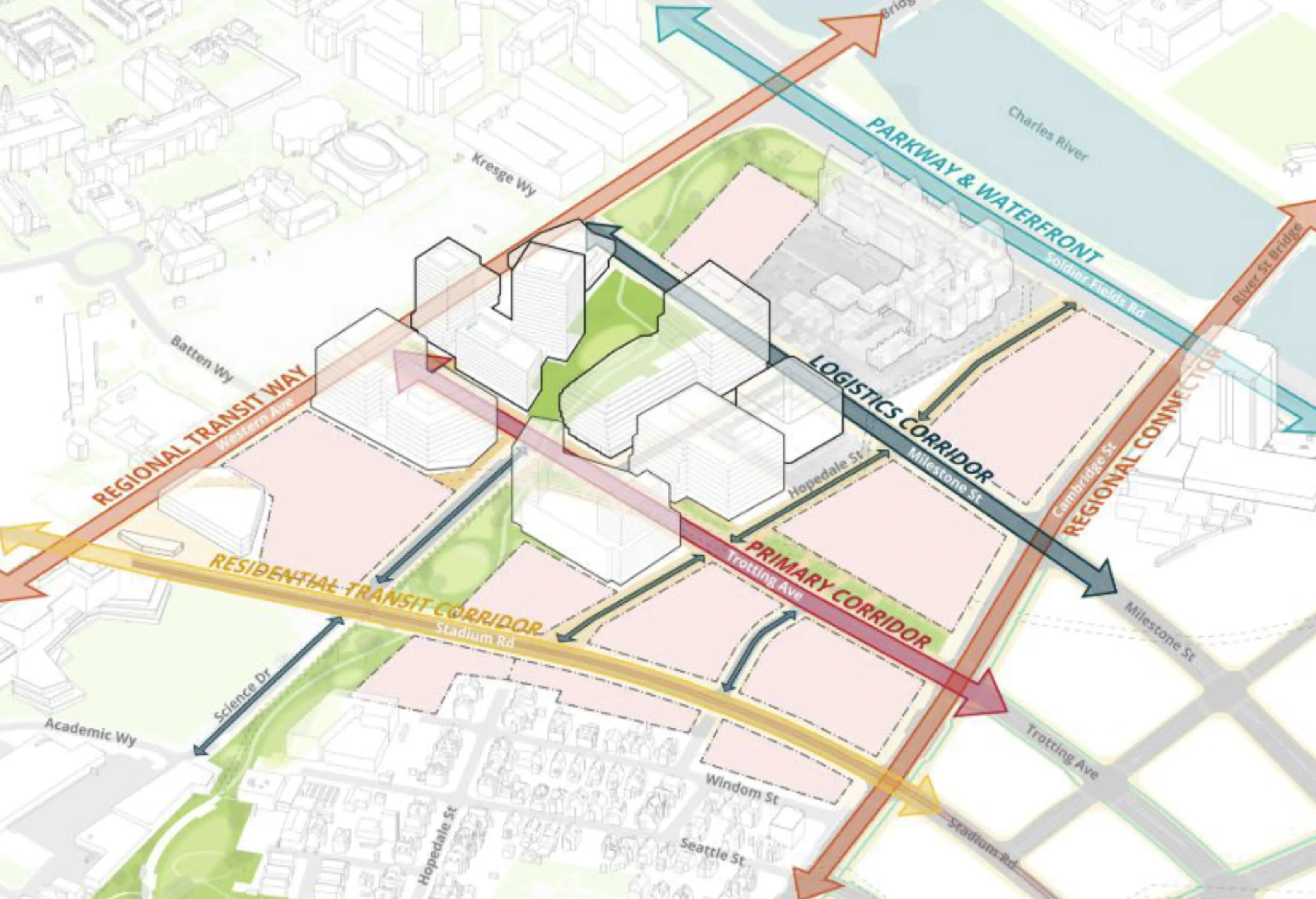
The updated ERC framework also establishes clear urban design principles intended to integrate the district into its surroundings. Taller, higher-density development will be concentrated in the center of the district, while building heights will “step down” toward the edges closest to nearby residential neighborhoods. Based on community feedback calling for safer walking and biking routes and stronger links between the ERC and surrounding neighborhoods, the new plan specifies a hierarchy of streets and transportation corridors designed to balance pedestrian, bicycle, transit, and vehicle movement.
The plan maintains at least 20 percent of the district as publicly accessible open space, including a network of parks, plazas, and flexible gathering areas connected to the Charles River, Western Avenue, and Cambridge Street. A half-mile long, east–west greenway running through the center of the district—with space for events and community programming—will serve as the primary organizing element for these public landscapes, and include a multi-use path for pedestrians, runners, and cyclists extending from Rena Park and the Honan-Allston Branch Library to the ERC.
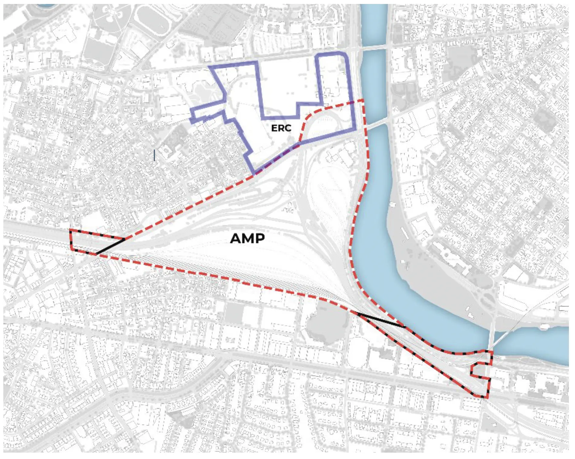
Despite the long-term ambitions for this innovation district, future development is currently constrained by major infrastructure projects—most notably the Allston Multimodal Project (AMP), a state-led effort to replace the aging Massachusetts turnpike (I-90) viaduct. A section in the southeast corner of the ERC, for example, cannot be developed until planning for the AMP is completed—and the planning effort hit a roadblock last year when federal funding for the project was rescinded.
The uncertain timeline and funding challenges for the highway project add complexity to the area’s buildout, reinforcing the need for a flexible, phased approach.
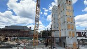
Earlier phases of ERC development, led by multinational real estate conglomerate Tishman Speyer, were approved separately and are already under construction or moving through the regulatory pipeline—although they reflect many of the same principles embodied in the plan adopted by the BPDA. Phase A, now virtually complete, includes lab and commercial space, housing, a hotel, and a conference center, along with initial infrastructure and public realm improvements along Western Avenue.
Tishman Speyer filed a letter of intent for phase B in 2024, the first step in seeking approval for the second phase of commercial development.
Notably, the April 16 approval does not mark the start of construction on the remaining portions of the ERC district’s developable acreage (about 30 of the 36 acres). Instead, it establishes a policy framework that will guide future zoning and development proposals.
The next formal step will be the creation of a Planned Development Area Master Plan, which will set detailed zoning, building parameters, and design guidelines. Individual projects will then undergo further review through Boston’s established regulatory process, including additional public input.