Harvard maps settle U.S.-Canada border

A library loan—with latitude

<i>Bowles's new pocket map of the United States of America: the British possessions of Canada, Nova Scotia, and Newfoundland, with the French and Spanish territories of Louisiana and Florida, as settled by the preliminary articles of peace signed at Versailles the 20th. Jany. 1783,</i> published by Carington Bowles (London, 1784)
Detail from <i>A map of the British dominions in North America, according to the Treaty in 1763</i>, published by Peter Bell (London, 1772)
Map of the boundary lines between the United States and the adjacent British provinces, drawn by Thomas Jefferson Lee, published for the United States House of Representatives (Washington D.C., 1843)
Carte des Etats-Unis de l'Amerique suivant le Traité de Paix de 1783/dédiée et présentée a s. Excellence Mr. Benjamin Franklin...par son trés humble et très obeissant serviteur, Lattré, published by Jean Lattré (Paris, 1784)
<i>The United States of America laid down from the best authorities: agreeable to the Peace of 1783,</i> published by John Wallis (London, 1783)
<i>The British colonies in North America,</i> published by William Faden (London, 1777)
<i>A map of the district of Maine: drawn from the latest surveys and other best authorities,</i> drawn by Osgood Carleton and published by Thomas & Andrews (Boston, 1795)

The Canada-United States border, the longest shared by two countries (5,525 miles, including Alaska), is uniquely calm. But establishing it was a protracted, unpeaceful pursuit, ultimately aided by one of the longest Harvard library loans on record.

The Treaty of Paris (1783), recognizing U.S. independence, defined the boundary ambiguously: “From the North West Angle of Nova Scotia, viz., That Angle which is formed by a Line drawn due North from the Source of the St. Croix River to the Highlands,” and so on, as the Map Collection’s Joseph Garver, librarian for research services and collection development, helpfully points out. But what was that angle? Where were the highlands? Did the Atlantic Ocean include the Bay of Fundy? Surveying availed little; the issues were political.

In 1828, the two countries submitted their claims to an arbiter, King William of the Netherlands. As evidence, the U.S. negotiators borrowed 22 maps and books from Harvard, more from the Boston Athenaeum and Massachusetts Historical Society, and shipped them off to The Hague.

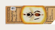
Each Harvard document bore an exhibit number and was inscribed with the terms of the loan (see the inset from the Peter Bell map of 1772). The British, seeking access to the interior via a military road from the Maritimes to Montréal, favored a southerly division, explains Garver, who has curated a 2012 exhibition of and lectured about the maps. The Americans imagined a line far north and east, close to the St. Lawrence (see Carington Bowles’s “new pocket map” of 1784, left, with its many other boundary eccentricities, to the modern eye). The king’s 1831 compromise dissatisfied the young (1820) state of Maine and its parent, Massachusetts (which still had vast landholdings there). The United States withheld assent.

After repeated threats of renewed belligerence, Secretary of State Daniel Webster, LL.D. 1824, and Lord Ashburton, facing the District of Columbia’s wilting summer heat, negotiated a resolution in 1842. (The rhetoric had also become hot: a British surveyor denounced an American’s work as “the most inflated humbug that ever flourished in the region of bombast.”)

In 1843, President Josiah Quincy wrote Webster for the loaned maps; nine were returned. President Edward Everett inquired again in 1848, and nine more reappeared, including Bell’s. President Jared Sparks secured the rest, after U.S. president Millard Fillmore ordered a search of the State Department files (Everett was then secretary)—in 1853, a quarter-century after they were checked out.

Read more articles by John S. Rosenberg

You might also like

What of the Humble Pencil?

Review: At the Harvard Art Museums’ new exhibit, drawing takes center stage

A Paper House in Massachusetts

The 1920s Rockport cottage reflects resourceful ingenuity.

This Connecticut Mine Was Once a Prison

The underground Old New-Gate Prison quickly became “a school for crime.”

Most popular

Is the Constitution Broken?

Harvard legal scholars debate the state of our founding national document.

Admissions after Affirmative Action

The composition of colleges’ incoming class after the Supreme Court ruling

How MAGA Went Mainstream at Harvard

Trump, TikTok, and the pandemic are reshaping Gen Z politics.

Explore More From Current Issue

Karla Cornejo Villavicencio smiling beside the pink cover of her novel "Catalina" featuring a jeweled star and eye.

Being Undocumented in America

Karla Cornejo Villavicencio’s writing aims to challenge assumptions. 

Brandon Terry, wearing a blue suit, standing before The Embrace, a large bronze sculpture of intertwined arms in Boston Common.

A New Narrative of Civil Rights

Political philosopher Brandon Terry’s vision of racial progress

Man splashing water on his face at outdoor fountain beside woman holding cup near stone building.

Why Heat Waves Make You Miserable

Scientists are studying how much heat and humidity the human body can take.