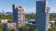

Terri Evans has a soft spot for Millennium Tower. The 60-story residential skyscraper, opened last year in Downtown Crossing, is “slim and graceful and conveys a sense of almost floating in the sky.”
Yet she and other volunteer guides who lead Boston By Foot architecture cruises along the Charles River and into Boston Harbor are equally devoted to traditional icons—the Citgo sign, Longfellow Bridge—and happy to delve into the topography, politics, and history that have long configured Boston’s built environment. “I love how cities grow and change,” Evans says, “and the clues that are left behind that give insight into what was there before.”
Passengers embark at the Charles Riverboat Company’s dock on the Lechmere Canal in East Cambridge. The boat passes the Museum of Science, then slips beneath both the old Boston and Maine Railroad Bridge and the new Leonard P. Zakim Bunker Hill Memorial Bridge before entering the Charles River Dam’s locks, which open and close depending on the tides, Evans explains. The inner harbor features views of Charlestown and the North End. Beyond, the financial district includes the Custom House Tower and India Wharf—the nineteenth-century center of international trade that’s now home to the Brutalist-era Harbor Towers.
Then it’s on to the Seaport District. The thriving business and tourist nexus was tidal mudflats until the late 1800s, then became a shipping hub before regressing into a no-man’s land of vacant lots, parking lots, and warehouses tied to the Port of Boston. Last spring workers erecting 121 Seaport Boulevard—a 17-story retail and office building—found the remains of a double-masted, wooden cargo ship that had sunk there between 1850 and 1870. Also among the striking structures is the Institute of Contemporary Art (ICA), a sleek, Lego-like building that’s both cantilevered over the water and sited on part of the emerging 47-mile Harbor Walk. “Boston is this amazing city,” declares Evans. “People can actually walk throughout the landscape on a pedestrian path that’s at or near the edge of the water.”